More Info & Questions
For information about renting or holding events at the new State Park contact Zach Neithercut: [email protected]

Our River. Our Future
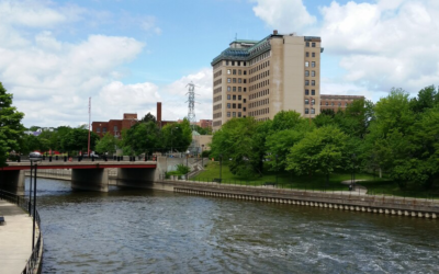
Nothing defines a community like a river running through it, touching communities and lives. The Flint Riverfront Restoration Project is bringing new life to this one-of-a-kind asset.
The Flint River is a 142-mile river located in the east-central portion of Michigan that flows through the city of Flint. The river’s immediate watershed encompasses more than 1,350 square miles and is home to more than 600,000 people. The river is also an important tributary of the larger Saginaw Bay Watershed, which encompasses a surface area of nearly 8,700 square miles and is home to 1.4 million people. The vast land area of the Saginaw Bay Watershed supports more than 138 endangered or threatened species, while its wetlands provide vital habitat for millions of migrating waterfowl and songbirds.
The stretch of the Flint River that runs through the city of Flint is the Saginaw Bay Watershed’s most degraded river segment. This degradation is a result of many factors including historical deforestation, intensive riverfront and floodplain development, unregulated discharges into the river, alterations to natural river flow (i.e. dams), and the construction of concrete channeling. The overall quality and amount of aquatic life in this segment of the Flint River has been so tarnished that little to no indigenous plant, fish, and other aquatic species currently exist.
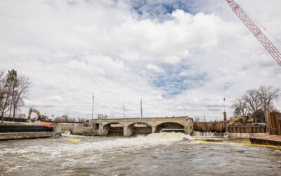
The Flint Riverfront Restoration Project is transforming a neglected resource into a healthy and vibrant community asset. The project vision calls for the rejuvenation of the Flint River and riverfront through the creation of water-based recreational opportunities, park improvements, underutilized property redevelopment, enhanced community connectivity, ecosystem restoration and improved stormwater/flood control.
HISTORY
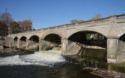
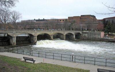
The key driver for the Flint Riverfront Restoration Project is the need to remove the Hamilton Dam, located along the Flint River in the heart of downtown Flint. Constructed in 1920, Hamilton Dam has a long history of service to the city of Flint. The dam facilitated milling operations for the region’s logging industry and served as a water source for local industries. Throughout its life, the dam helped regulate the flow of water in the Flint River. In the 1960’s, the dam served as the upstream anchor point for a U.S. Army Corps of Engineers’ Flood Control Project. Over time, the dam devolved into a community hazard. It was ultimately classified as a High Hazard Critical Dam by the Michigan Department of Natural Resources and Environment.
In late 2009, the City of Flint engaged a team of consultants to develop a preliminary design for modifications to the Hamilton Dam, building upon past studies of the riverfront area. The City saw an opportunity to establish a strategy for change that extended beyond Hamilton Dam and thus directed the consultant team to develop a restoration plan for Flint’s riverfront. In 2010, from this planning process, emerged the Flint Riverfront Restoration Plan. The plan provides a vision for transforming the Flint riverfront from a neglected resource into a healthy and vibrant community asset.

RESOURCES
To date, more than $40 million of funding has been raised to develop and implement the Flint Riverfront Restoration Plan. This includes funding provided by the Charles Stewart Mott Foundation; The Hagerman Foundation; the Saginaw Bay Watershed Initiative Network; the U.S. Environmental Protection Agency; the Michigan Department of Environment, Great Lakes & Energy; the Michigan Natural Resources Trust Fund; the Michigan Department of Transportation; the Great Lakes Restoration Initiative; the Consumers Energy Foundation; and the Michigan Department of Natural Resources.