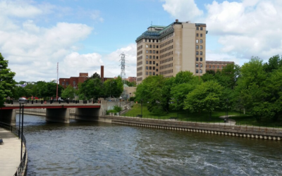
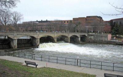
The key driver for the Flint Riverfront Restoration Project is the need to remove the Hamilton Dam, located along the Flint River in the heart of downtown Flint. Constructed in 1920, Hamilton Dam has a long history of service to the city of Flint. The dam facilitated milling operations for the region’s logging industry and served as a water source for local industries. Throughout its life, the dam helped regulate the flow of water in the Flint River. In the 1960’s, the dam served as the upstream anchor point for a U.S. Army Corps of Engineers’ Flood Control Project. Over time, the dam devolved into a community hazard. It was ultimately classified as a High Hazard Critical Dam by the Michigan Department of Natural Resources and Environment.
In late 2009, the City of Flint engaged a team of consultants to develop a preliminary design for modifications to the Hamilton Dam, building upon past studies of the riverfront area. The City saw an opportunity to establish a strategy for change that extended beyond Hamilton Dam and thus directed the consultant team to develop a restoration plan for Flint’s riverfront. In 2010, from this planning process, emerged the Flint Riverfront Restoration Plan. The plan provides a vision for transforming the Flint riverfront from a neglected resource into a healthy and vibrant community asset.